

Wrangell St Elias National Park
Alaska is home to 4 of the largest National Parks in the United States, the biggest of them all is Wrangell St. Elias National Park with a total acreage of 13.2 million; which is larger than Yellowstone, Yosemite, and the country of Switzerland combined.
This is a land of mountains, glaciers, and pure wilderness. Comprised of 3 converging mountain ranges (The Wrangell’s, The Chugach, and St Elias Range), Wrangell St. Elias is home to 9 of the 16 highest peaks in the United States, and ¼ of all the glaciers in North America.
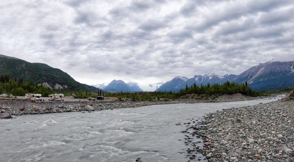
Despite being the largest National Park in North America, it also is one of the least accessible. There are only two roads into the park. The Nesbena Road provides access to the Northern areas of the park (Traveler’s Tip- we have heard that the end of the Nebesna Road is a great spot for Aurora viewing in the early fall). And the McCarthy Road on the Western edge of the park, providing access to the historic towns of McCarthy and Kennecott, and our unpaved gateway to adventure.
Of course, as with all things Alaskan, if you’re keen on visiting Wrangell- St. Elias National Park, and don’t want to do any driving, you can book a flightseeing tour of this incredible park- which we hear is absolutely spectacular, and expensive. Local companies we’ve heard great things about include Wrangell Mountain Air and Tok Air Service.
The McCarthy Road
When Alaskans tell you, a road is “bad” you better listen up and pay close attention. Alaska is not a state known for its pristine roadways, most locals are more than accustomed to driving on less than spectacular surfaces, but the McCarthy Road takes this to a whole other level, proudly sporting the nick-name, “the worst road in Alaska”.
If you’ve already watched the video then you already know, that our experience driving the McCarthy Road did not live up to all the hype. The road was smooth as butter, when you compare it to our experiences driving the final miles of The Top Of The World Highway, and of course the infamous Dalton Highway the word unremarkable comes to mind. We talked to a few locals about this when we reached McCarthy and they told us that while the road has vastly improved over the years it still can be incredibly dangerous and unpredictable. Like all things in Alaska conditions vary based on time of year, recent weather, and a thousand other factors. The best way to find out the current condition of the road is to call ahead to the Chitina Ranger Station (907) 823-2205.
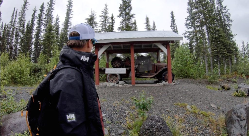
The McCarthy Road is 59.4 miles long and chock full of its own very special and unique and history. To cover it all would take multiple posts, and a whole lot of details to do it justice. If you’re planning on making the trip along the road or are just interested in learning about the history of this region of Alaska, we highly recommend you take the time and download the National Park Service’s Audio tour of the road- download your copy here. You can also pick up a hard copy of this CD for free at the Wrangell-St. Elias National Park & Preserve Visitor Center in Copper Center, Chitina Ranger Station or Slana Ranger Station, just don’t make the same mistake we did, and double-check your vehicle has a CD player first!
McCarthy, Alaska
Welcome to McCarthy Alaska, population 28. True story.
The town of McCarthy sprung up in the early 1900s shortly after the discovery of Copper in the mountain peaks above the nearby Root Glacier. When the Kennicott Mining Corporation opened the mines in 1903, they provided workers with everything they needed, with one exception, drinking and gambling were not permitted within the company-owned town limits. Necessity is the mother of invention, and in this case, a new town established just outside of Kennecott filled that need, and McCarthy Alaska was born. A place where weary miners could enjoy, “Wine, women, and song”, without big brother looking down on them.
Today, McCarthy is home to seasonal mountaineering guides, bush pilots, bartenders, and a host of other characters, that give this special place its very special vibe.
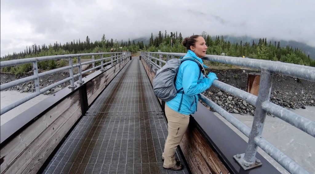
There are no private cars permitted in McCarthy or Kennecott so if you’re planning on taking this adventure you’ll need to be prepared to park your vehicle and take the footbridge over the Kennicott River, where you can pick up the shuttle into town ( the shuttle drops at both McCarthy & Kennecott) or you can easily make the walk into McCarthy. You can find more information about the shuttle schedule and costs here: https://www.wrangellmountainair.com/shuttle-service-between-mccarthy-kennicott
Kennecott, Alaska
In 1900 a pair of hikers spotted a large patch of copper ore high above on the ridge above the Kennecott Glacier. By 1903 The Kennecott Mining Company was established, and in turn the town of Kennecott, Alaska was born. The mines of Kennecott operated from 1906-1935 and during its time of operation was the richest Coppermine in the world. The history here runs deep. Time and harsh Alaskan weather have taken their tolls on the buildings here, which in truth really adds to the allure.

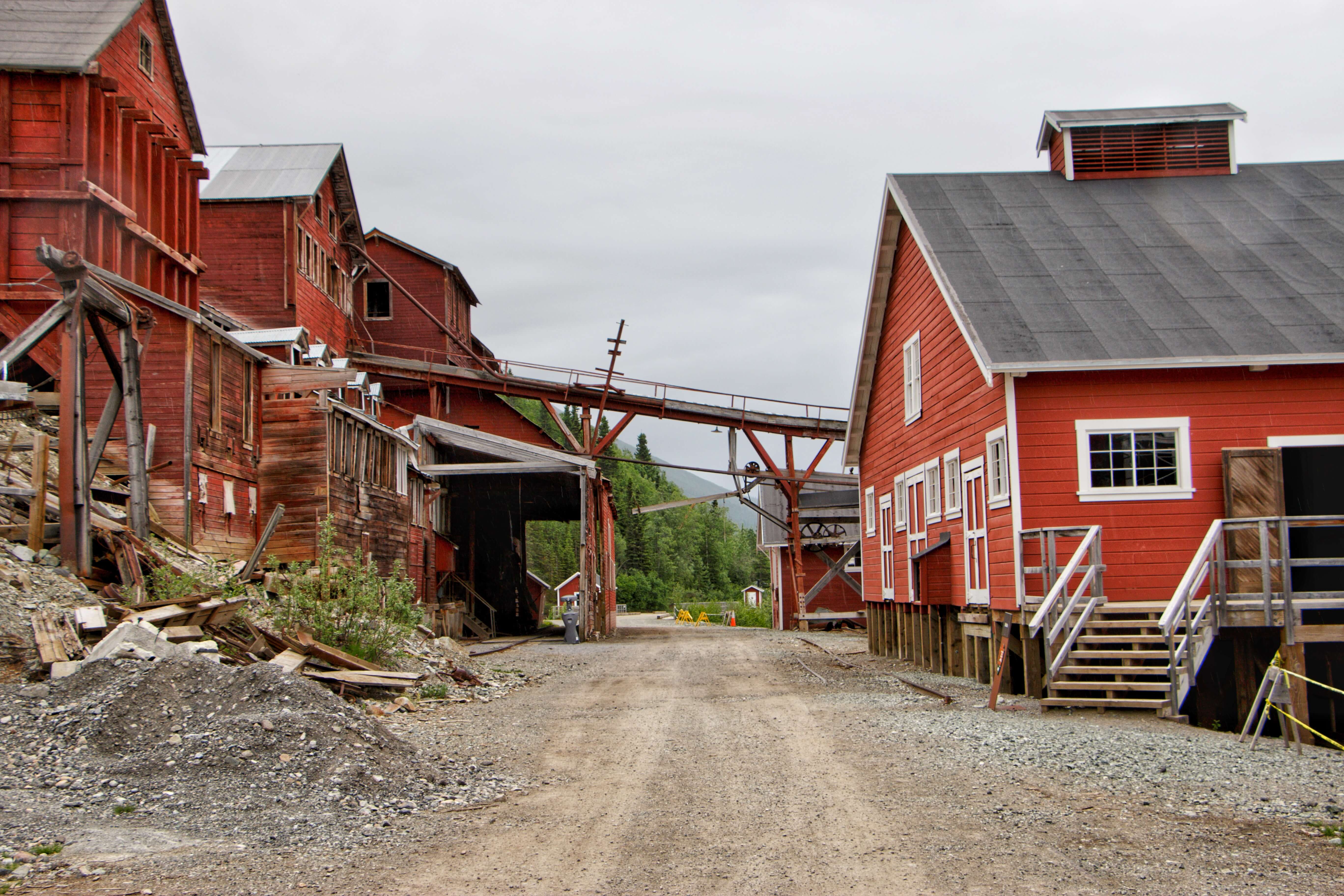

In 1998 The National Park Service gained the rights to the majority of the historic buildings in Kennecott and began the slow and arduous process of restoring them to their former glory. Today you can take a self-guided tour through this historic town or you can sign up for a guided tour and gain access to buildings closed to the general public including the 14-story mill.
Free Walking Tour Map Of Kennecott: https://www.nps.gov/wrst/learn/historyculture/upload/Kennecott-Walking-Tour-Revised-June-2020-508.pdf
Kennecott Town & Mill Tour With St. Elias Alpine Guides: https://www.steliasguides.com/trips/kennecott-mill-town-tour/
Root Glacier
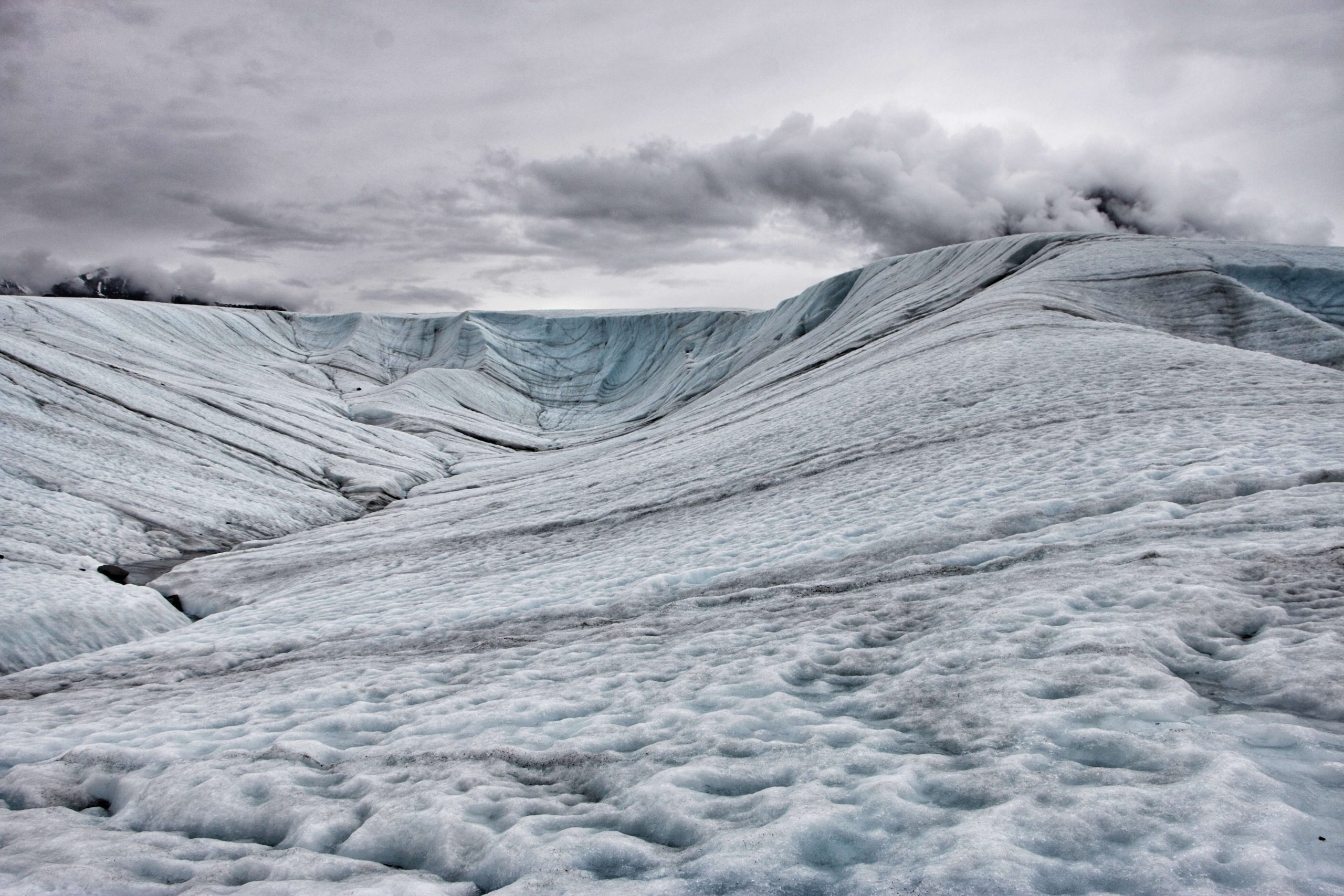
2 Million years old with ice 300- 500 feet thick, and accessible by a short 2-mile hike from historic Kennecott, Root Glacier just might be the perfect do-it-yourself glacier adventure.


While most glacier treks require you to have high tech gear, and years of experience to safely take on, Root Glacier is a bit of an exception to this rule. Root is a relatively stable glacier, that in the summer remains free of fresh snow that on other glaciers, commonly disguises dangerous crevasses- making it an ideal option for someone armed with a trusty pair of micro-spikes or crampons and a head full of common sense.
Trail Details:
Distance: 4 Miles Roundtrip + Any Mileage You Cover On The Ice
Route Type: Out and Back
Trail Surface: Dirt, Loose Gravel and Ice
Trailhead: Walk through the Kennecott Mill Town taking the main street. Head north Root Glacier will be visible in the distance. Follow the marked trail the remaining distance.
Even a “stable glacier” can be a dangerous glacier, if you decide to walk on the glacier, use extreme caution. The ice can be very slippery and dangerous, crampons or ice spikes are NOT optional.
Essential Gear For Glacier Trekking:
- Microspikes or Crampons
- A Pair Of Sturdy Hiking Boots
- Layers Of Warm Dry Clothing
- Day Pack
- First Aid Kit
- Water Bottle
- Snacks
- Bear Spray
- Water Resistant Action Camera
Not feeling super confident in your ice skills? That’s ok too, St. Elias Alpine Guides offers guided hikes on the glacier (more info about that here). These guides are equipped with years of experience, knowledge, and most importantly safety gear.
Guess, sometimes it’s just as well that a thing doesn’t live up to the hype. 🙂
Hahahaha isn’t that the truth- we heard some nightmare stories about that road 🙂